
The Site
Facilities & terminal layout
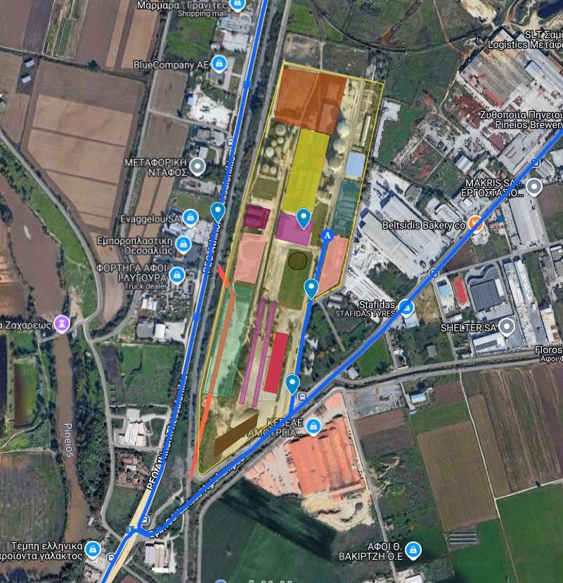
An interactive plan of the 16 functional zones, the technical factsheet and the photographic record of the site.
Interactive plan
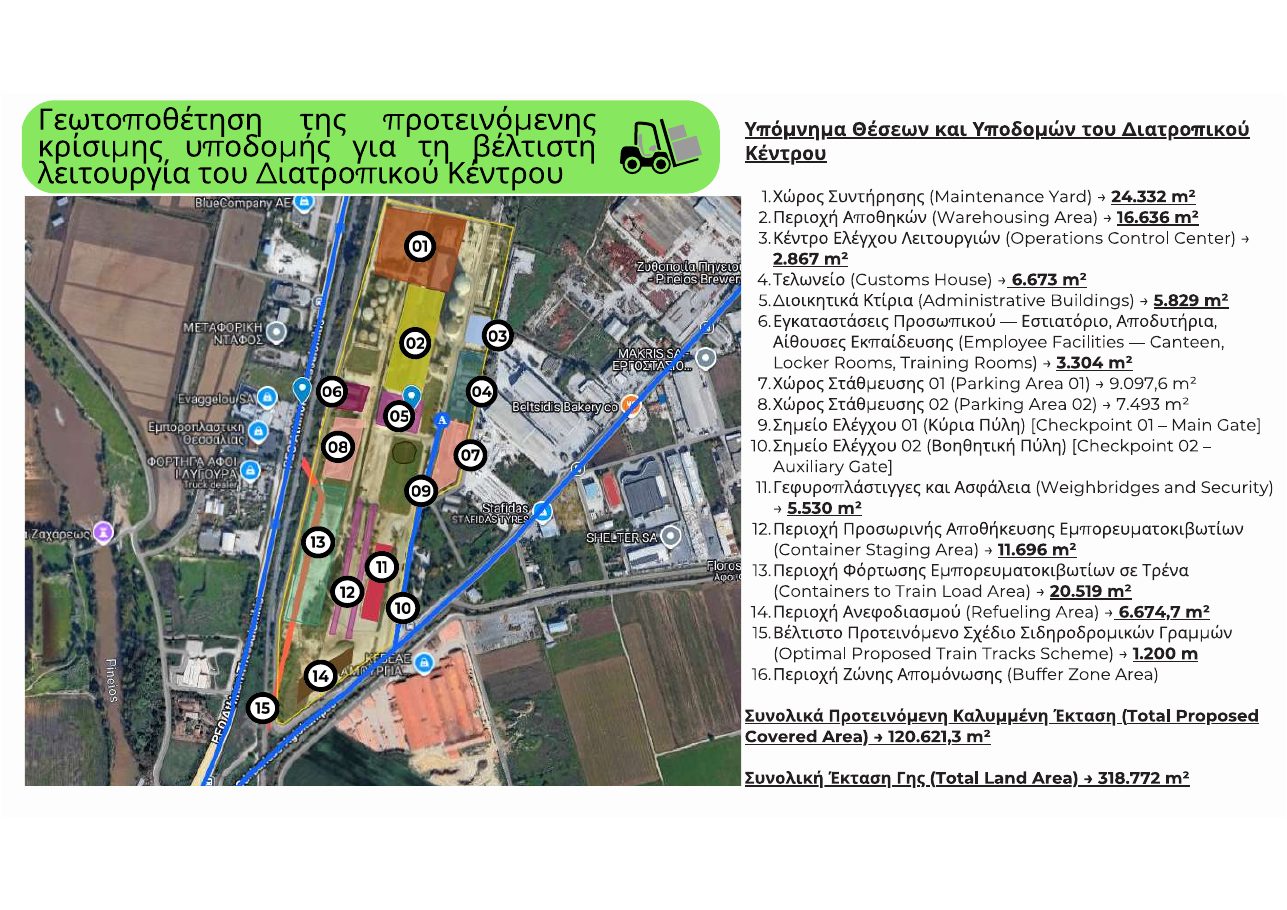
The 16 zones of the proposed terminal
Select a zone to see its area and function. The plan is fully keyboard accessible; the table that follows carries the same information in text form.
Select a zone on the plan (click or press Enter) for details.
Zone 1
- Name
- Area
- Description
Schematic representation; not a survey drawing. Areas are taken from the geolocation study of the proposed infrastructure.
Technical factsheet
Areas per zone
| No. | Zone / infrastructure | Area | Description |
|---|---|---|---|
| 01 | Maintenance Yard | 24.332 m² | Maintenance and repair of rolling stock, terminal tractors and lifting equipment. |
| 02 | Warehousing Area | 16.636 m² | Covered storage, cross-docking and value-added services for agri-food cargo. |
| 03 | Operations Control Center | 2.867 m² | Central operations control, TOS, gate and rail movement monitoring. |
| 04 | Customs House | 6.673 m² | Customs control, inspection/sampling area and bonded storage. |
| 05 | Administrative Buildings | 5.829 m² | Administration, commercial services, offices for carriers and customs brokers. |
| 06 | Employee Facilities | 3.304 m² | Canteen, locker rooms and training rooms — infrastructure for skills programmes. |
| 07 | Parking Area 01 | 9.097,6 m² | Truck waiting area with a document pre-check zone. |
| 08 | Parking Area 02 | 7.493 m² | Staff and visitor car parking, including accessible bays at the entrance. |
| 09 | Checkpoint 01 — Main Gate | — | Main truck in/out gate with plate recognition and security checks. |
| 10 | Checkpoint 02 — Auxiliary Gate | — | Secondary gate for service vehicles, emergencies and rail staff. |
| 11 | Weighbridges & Security | 5.530 m² | Cargo weighing, seal verification and terminal security infrastructure. |
| 12 | Container Staging Area | 11.696 m² | Stacking of import/export, empty and reefer containers with power supply. |
| 13 | Containers to Train Load Area | 20.519 m² | Truck ↔ train transhipment zone, supporting full-train handling without splitting. |
| 14 | Refuelling Area | 6.674,7 m² | Refuelling of terminal vehicles; provision for e-charging and alternative fuels. |
| 15 | Proposed Train Tracks Scheme | 1.200 m | Optimal proposed in-terminal track scheme, 1,200 m in total length. |
| 16 | Buffer Zone Area | — | Perimeter buffer towards neighbouring land uses — noise, lighting and visual screening. |
| Total proposed covered area | 120.621,3 m² | ||
| Total land area | 318.772 m² | ||
318.772 m²
Total land area
120.621,3 m²
Total proposed covered area
1,200 m
Proposed length of rail tracks
Existing condition
The premises of the former sugar factory
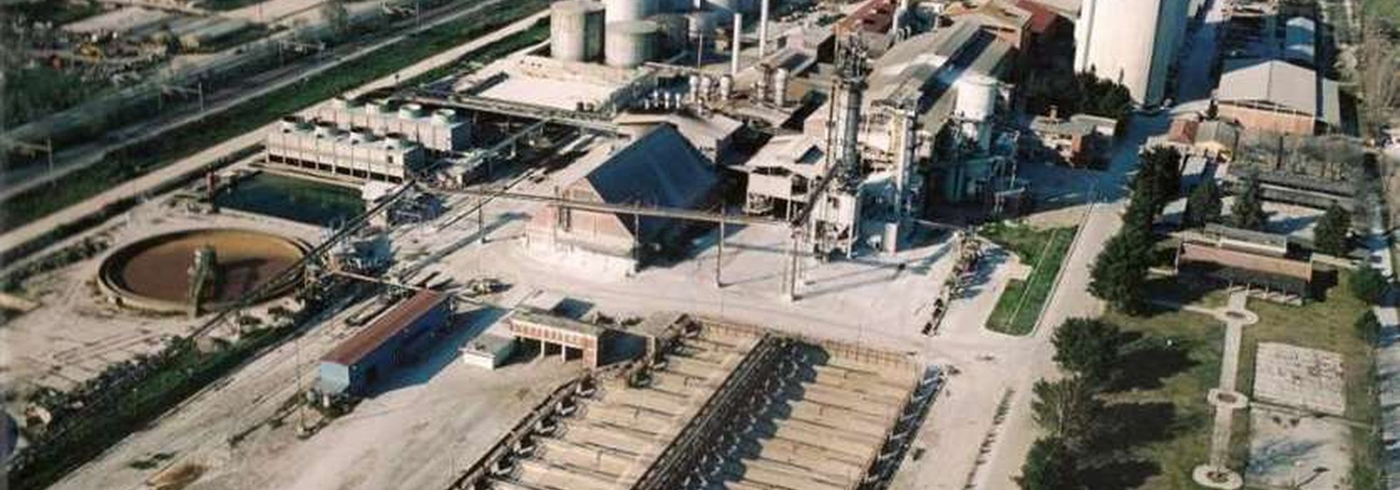
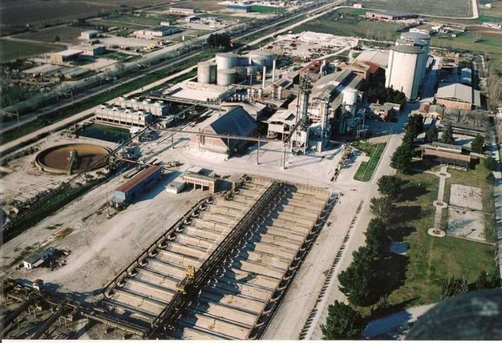
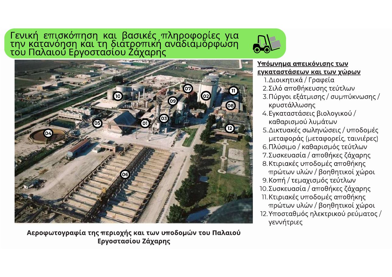
The aerial photograph records the infrastructure of the old factory, part of which may be reused in the intermodal redevelopment of the site.
| No. | Facility / space |
|---|---|
| 01 | Administration / Offices |
| 02 | Beet storage silos |
| 03 | Evaporation / concentration / crystallisation towers |
| 04 | Wastewater treatment facilities |
| 05 | Pipe networks / conveying infrastructure (conveyors, belts) |
| 06 | Beet washing / cleaning |
| 07 | Sugar packaging / warehouses |
| 08 | Raw material warehouse buildings / auxiliary spaces |
| 09 | Beet cutting / slicing |
| 10 | Sugar packaging / warehouses |
| 11 | Raw material warehouse buildings / auxiliary spaces |
| 12 | Electrical substation / generators |
Photographic material
Gallery
Usage rights
The photographic and cartographic material comes from the project documentation. For reproduction in publications, contact press@larissa-ict.uth.gr.